Surroundings
Els Ports
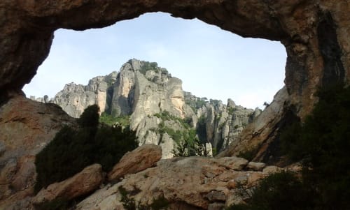
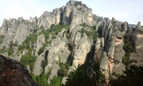
The Natural Park of Els Ports extends in the Catalan area of the mountains of Els Ports, a massif that exceeds the limits of Terres de l'Ebre and enters the provinces of Teruel (Aragon) and Castellón (Valencian Community). These mountain ranges stand out for the richness of the fauna and flora that live here and, in fact, are the refuge of many endangered animal and plant species. The presence of the Hispanic goat and the beech populations, which here have the southernmost enclave in Europe, stand out.
In addition, the geological formations draw a characteristic landscape unique in Catalonia.
We must not forget, either, the historical links that have been established between the populations that border the massif and the farmhouses in the area, now abandoned. The use of the natural resources of these places, such as hunting, livestock, timber extraction, lime and glue production, or the construction of snow wells, recall times of intense human presence in this natural space.
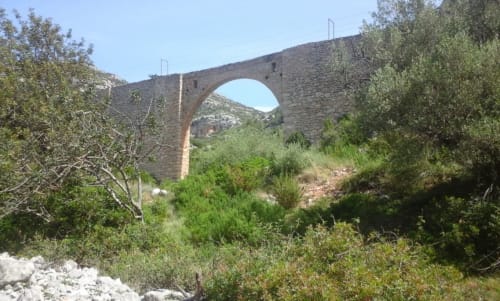
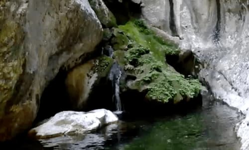
Lo pont de les Canals
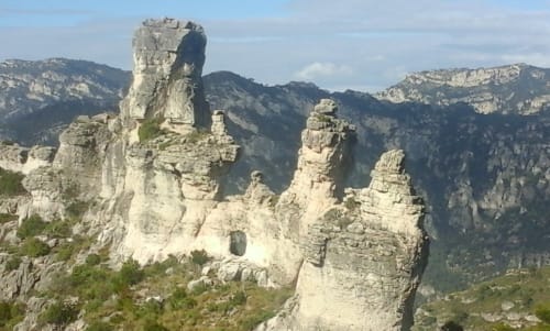
Lo Castellet
As if it were a castle, a wall molded by the passage of time, and very unknown to most, it is located at the descent of l'Airosa, by a variant to the left.
El Raco del Moro
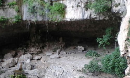
La Cova pintada
Shelter, located in a side ravine of the ravine of Lloret, the path with little unevenness and with imposing walls, leads us to the end of the ravine closed by a wall, and at the base, the painted cave. The cave, from afar does not seem anything special, when you are inside it is something else, the rough ceiling molded by the passage of time has given rise to a variety of colors that can only be imagined, seeing them.